
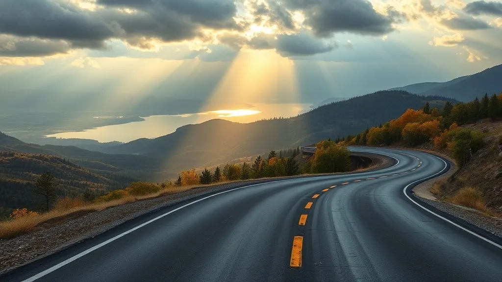
How to plan scenic drives minimizing crowds and maximizing unique views?
After more than fifteen years navigating the most spectacular and sometimes most congested roads on the planet, I’ve refined the art of discovery. The secret to planning scenic drives that truly minimize crowds and maximize unique views isn't about magical timing alone; it's a multi-layered approach rooted in deep preparation and a willingness to deviate.
A common mistake I see amateur road trippers make is simply following the most popular "scenic route" marked on conventional maps or recommended by mainstream travel blogs. While these routes offer beauty, they often lead to bottlenecks and a shared, rather than unique, experience. True gems require a more nuanced strategy.
In my experience, the first step is to redefine "scenic." It's not just about the postcard vista; it's about the feeling of discovery, the quiet contemplation, and the unexpected perspective. This leads us to the critical concept of **strategic timing beyond just the season**.
-
Off-Peak Season, Yes, But Also Off-Peak Hours: Everyone knows to avoid peak summer, but even in the shoulder seasons, major attractions can be swamped mid-day. Aim for sunrise or late afternoon/sunset for popular viewpoints. Not only are the crowds thinner, but the light is often far superior for photography and appreciation.
-
Mid-Week Advantage: Weekends are for locals and short-trip travelers. If your schedule allows, plan your drive for Tuesday through Thursday. You’ll find quieter roads, easier parking, and a more serene atmosphere at overlooks and trailheads.
Next, we must delve into **the art of route selection**, a practice far more sophisticated than simply toggling "avoid highways" on your GPS. This is where you truly start to unearth the unique views.
-
Beyond the National Parks' Main Roads: While national parks are undeniably beautiful, their main scenic drives are often designed for high traffic. Instead, look for lesser-known state scenic byways, county roads, or even forest service roads that parallel or intersect the main arteries. These often offer equally stunning, but far more secluded, views.
-
Consult Topographical Maps & Satellite Imagery: This is a game-changer. Before I even consider a route, I'm poring over detailed maps. Look for contour lines that suggest hidden overlooks, "unnamed" peaks, or river bends that might offer a unique perspective not signposted on tourist maps. Satellite imagery can then confirm accessibility or reveal hidden pull-offs.
-
Local Intelligence is Gold: Don't underestimate the power of a quick call to a local visitor center (before you arrive!) or a chat with a park ranger or local shop owner once you're there. Ask them, "Where do *you* go to escape the crowds for a beautiful view?" Their insights are invaluable and often point to hidden gems not found in guidebooks.
The most profound views are rarely handed to you on a silver platter; they are earned through diligent research and a willingness to explore beyond the obvious.
Finally, **embrace the philosophy of "the intentional detour."** This isn't about getting lost, but about remaining flexible enough to seize unexpected opportunities. I’ve discovered some of my most cherished views by noticing an intriguing dirt road turning off a state highway, or spotting a small, unmarked sign for an "historic overlook" not mentioned in any guide.
This approach requires a mindset shift: instead of rigidly adhering to a pre-planned itinerary, allow for serendipity. Equip yourself with a full tank of gas, some snacks, and an open mind. Sometimes, the most unique view isn't a grand panorama, but a quiet moment by a hidden waterfall or a sun-drenched meadow found simply by following your intuition down a less-traveled path.
Lack of Pre-Trip Research
A common pitfall I've observed over my fifteen years traversing the continent's most breathtaking routes is the profound impact of **insufficient pre-trip research**. Many aspiring scenic drivers simply plot a point A to B, assuming the journey itself will unfold perfectly, oblivious to the nuances that truly define an exceptional road trip experience. This oversight frequently leads to frustrating encounters: unexpected road closures, peak-season crowds swarming every viewpoint, or arriving at a destination only to find its iconic features obscured by unfavorable weather or seasonal changes. In my experience, the difference between a memorable, tranquil drive and a chaotic, disappointing one often boils down to the effort invested before the ignition key even turns."The open road rewards the prepared mind, not just the open spirit. Without foresight, even the most stunning vistas can become merely a backdrop to frustration."Effective research isn't just about finding the quickest route; it's about understanding the **rhythm and pulse of your chosen journey**. It involves delving into several key areas that, when combined, paint a comprehensive picture of what to expect and, crucially, how to optimize for solitude and spectacular views. Consider these critical research pillars:
- Seasonal Nuances & Microclimates: Don't just check the general weather forecast. Research historical weather patterns, understand shoulder seasons for fewer crowds, and be aware of microclimates that can dramatically alter conditions along a short stretch of road. A mountain pass might be clear while the valley below is fogged in.
- Peak Visitation Times & Local Events: Every iconic scenic route has its peak times – be it fall foliage in New England, wildflower blooms in California, or summer holidays at national parks. Cross-reference your travel dates with local event calendars, school holidays, and known tourist surges.
- Road Conditions & Maintenance Schedules: Many truly scenic routes, especially those in mountainous or remote regions, are subject to seasonal closures, construction, or maintenance. Checking state DOT websites or park service alerts is non-negotiable to avoid dead ends or lengthy detours.
- Viewpoint Logistics & Photography Angles: For photographers or those seeking the absolute best vistas, a quick satellite map review can reveal optimal pull-offs, sun angles at different times of day, and even alternative, less-trafficked viewpoints that offer equally stunning perspectives.
Reliance on Popular Apps/Guides
A common pitfall I've observed over my decades exploring backroads and byways is the almost universal over-reliance on popular navigation apps and crowd-sourced guides. While undeniably convenient for getting from A to B, these tools often inadvertently funnel travelers into the very same congested viewpoints and scenic overlooks they're trying to avoid.
The algorithms powering these platforms are typically optimized for efficiency, popularity, and ease of access. They prioritize routes with robust data, numerous user reviews, and well-trodden paths, making it incredibly difficult to stumble upon those truly secluded, breathtaking vistas that define an unforgettable road trip.
In my experience, thinking that popular apps will lead you to unique, crowd-free scenic spots is like expecting a five-star hotel to have a secret, private pool no one else knows about. If it's easy to find, everyone else has already found it.
This creates an "echo chamber" effect: a beautiful spot gets popular, more people review it, it rises in search rankings, and even more people go. This cycle guarantees you'll be sharing that "secret" waterfall or mountain pass with dozens, if not hundreds, of others.
To truly unearth those less-traveled gems, you must actively diversify your planning toolkit and challenge the digital mainstream. It's about shifting your mindset from passively consuming information to actively seeking out unique insights.
Here’s how I approach planning to break free from the app-trap:
- Go Analog First: Before touching a digital screen, spread out a detailed physical map – a Gazetteer, an Atlas, or even a local state map. Look for unnumbered roads, scenic byway designations (often marked with specific symbols), and areas where contour lines suggest dramatic elevation changes without major highways. These often hint at overlooked scenic routes.
- Leverage Niche Guides: Seek out older, out-of-print regional travel guides or specialized books on local geology, history, or hiking. These often contain references to lesser-known viewpoints or backroads that haven't been "discovered" by the digital masses. Libraries and used book stores are invaluable resources.
- Tap into Local Intelligence (Pre-Trip): Don't wait until you're there. Call small-town visitor centers, local historical societies, or even independent outdoor gear shops in the region you plan to visit weeks in advance. Ask them about their favorite "secret" drives or overlooks that don't get much tourist traffic. Their insights are golden.
- Use Satellite Imagery for "Reverse Engineering": Once you've identified a general area of interest from your analog maps, switch to satellite view on a mapping platform. Look for distinct geological features like river bends, canyon rims, or mountain passes, then trace nearby roads that might offer vantage points. Often, these roads aren't prominently featured in standard navigation.
- The "Adjacent Discovery" Principle: If a popular viewpoint is unavoidable, use it as a launchpad. Instead of staying there, look at the immediate surrounding area on your map (both physical and satellite). Often, a parallel, less-developed road or a short detour will lead to a similar, equally stunning view without the crowds.
- Embrace the "Scenic Detour" Mindset: Be prepared to add time to your journey. The most rewarding scenic drives are rarely the most direct. Prioritize curiosity over efficiency, allowing yourself to follow an intriguing side road that catches your eye on the map.
By intentionally stepping away from the most popular digital pathways, you empower yourself to craft a truly unique itinerary, discovering views that feel personal and pristine, rather than pre-packaged and crowded. This is where the real magic of road-tripping unfolds.
Step-by-Step: A Practical Framework to Plan Crowd-Free, View-Rich Scenic Drives
After decades of exploring North America's most breathtaking byways, I've distilled my planning process into a repeatable framework. This isn't about rigid adherence, but rather a strategic mindset designed to consistently deliver those coveted crowd-free moments and unforgettable vistas. It's about working smarter, not just harder, to escape the tourist hordes.
My approach centers on proactive research and intelligent timing, ensuring your journey unfolds with maximum serenity and visual impact. Let's break it down, step by practical step.
-
Define Your "Why" and "When": Your Foundational Blueprint
Before you even glance at a map, clarify your core objective. Are you chasing solitude above all else, or specific photographic opportunities? What kind of scenic beauty truly resonates with you – rugged coastlines, towering peaks, or expansive deserts?
This initial clarity is paramount. In my experience, a common mistake is embarking on a "scenic drive" without a precise vision, leading to generic experiences. Simultaneously, set your broad timing parameters. While later steps dive into micro-timing, identify your preferred season. Are you prepared for potential snow closures in a mountain pass, or do you seek the vibrant hues of autumn?
The clearer your vision for the trip, the more precisely you can tailor your efforts to achieve it. Don't just plan a drive; plan an experience.
-
Strategic Route Selection: Beyond the Postcard Views
This is where true expertise comes into play. Don't just pick the most famous scenic highway listed in every guidebook. I always look for parallel routes, lesser-known state or county scenic byways, or even well-maintained forest service roads that offer similar vistas with significantly reduced traffic.
For instance, instead of solely focusing on the iconic Going-to-the-Sun Road in Glacier National Park during peak season, I'd investigate alternative routes like the Flathead Valley Scenic Drive or explore the east side of the park more thoroughly, often finding equally stunning views with fewer cars. These alternatives often require a bit more digging but yield immense rewards.
- Leverage Local Resources: Consult state Department of Transportation (DOT) websites for designated scenic byways that might not appear on mainstream travel blogs.
- Study Topographic Maps: These reveal elevation changes and potential viewpoints, helping you identify roads that hug ridgelines or river valleys, often away from primary thoroughfares.
- Look for "Loops" and "Spokes": Instead of a single A-to-B route, plan a loop that incorporates a famous section but then diverts onto less-traveled spokes, allowing you to sample the popular without being swallowed by it.
-
Mastering Micro-Timing: The Daily Rhythm of Crowds
Even on a popular route, you can achieve crowd-free moments by understanding the rhythm of visitor traffic. This involves both the day of the week and the time of day. Weekdays are almost always preferable to weekends, particularly for national parks and well-known scenic drives.
Within any given day, aim for early mornings or late afternoons. The "golden hour" light is not only phenomenal for photography but also coincides with a significant drop in visitor numbers as people head for dinner or their accommodations. Think of it like a stock market: there are peak and off-peak hours for scenic spots, and your goal is to invest in the latter.
- Sunrise Advantage: Arriving at a popular viewpoint for sunrise often means having it entirely to yourself, enjoying the tranquility before the first tour buses arrive.
- Sunset Serenity: Similarly, lingering until sunset provides not only dramatic lighting but also a chance to experience the landscape as most others are leaving.
- Lunch Hour Lull: Sometimes, a mid-day stop at a less-traited overlook during the peak lunch rush can offer a brief window of solitude.
-
Deep Dive Research & Data Synthesis
This step moves beyond general planning into granular detail. I leverage a suite of tools far beyond basic mapping applications. A common mistake I observe is relying solely on mainstream travel guides, which by definition, highlight what's already popular.
My process involves cross-referencing information from diverse sources. I scour local tourism board websites, often finding obscure 'local favorites' or events that dictate crowd levels. I also dive deep into niche online forums and blogs dedicated to specific regions or activities (e.g., hiking forums for trailheads, photography forums for viewpoints). I've found invaluable real-time insights from official park webcams, providing a snapshot of current conditions and crowd densities before I even leave home.
- Visitor Statistics: Many national parks and popular attractions publish monthly or even daily visitor data. Analyzing these trends helps identify truly off-peak periods.
- Social Media Geo-tags: While counter-intuitive, looking at recent geo-tagged posts can give you a sense of current crowd levels at specific viewpoints or attractions.
- Weather Patterns: Understanding microclimates and typical weather patterns for your chosen route and time of year is crucial for both safety and maximizing views. Fog, rain, or clear skies can drastically alter an experience.
-
Accommodation & Pacing: Your Sanctuary and Your Speed
Where you sleep and how fast you travel profoundly impacts your ability to enjoy crowd-free views. Instead of staying directly in the most popular gateway towns, I often opt for smaller, adjacent communities or even dispersed camping just outside park boundaries. This allows for easier access to early morning or late evening excursions without battling prime-time traffic.
Furthermore, avoid the temptation to cram too much into each day. A road trip, particularly a scenic one, is a marathon, not a sprint. By slowing down, you create space for spontaneous detours, linger longer at captivating viewpoints, and truly immerse yourself in the landscape. This unhurried pace is, in itself, a form of crowd avoidance, as you're not rushing from one packed spot to the next.
- Consider Smaller Towns: Instead of staying in Sedona, Arizona, look at Cottonwood or Camp Verde for more affordable and quieter options with easy access.
- Dispersed Camping: For maximum solitude, research dispersed camping options on public lands (National Forests, BLM land) near your route.
- Build in "Buffer Time": Always allocate extra time for unexpected stops, short hikes, or simply sitting and soaking in a view that captures your attention.
-
Embrace Flexibility: The Expert's Edge
Even with the most meticulous planning, the expert road tripper knows that flexibility is key. Weather can change, a road might be unexpectedly closed, or a local might offer an irresistible tip for a hidden gem. My best trips have often included significant pivots from the original itinerary, leading to discoveries I never could have planned.
Have a primary plan, but also a "Plan B" or even "Plan C" for popular stops. If a particular overlook is swarming with people, know of an alternative nearby. This adaptability prevents frustration and opens the door to serendipitous moments, which are often the most memorable. The goal isn't perfect execution of a plan, but perfect execution of an *experience*.
The most profound road trip memories aren't always found on the map; they're created when you allow yourself to deviate from it.
Step 1: Deep Dive Research & Alternative Route Mapping
In my fifteen years on the road, I've learned that the secret to truly spectacular, crowd-free drives begins long before you pack your bags. It starts with what I call a "Deep Dive Research & Alternative Route Mapping" phase, the foundational step that separates the casual tourist from the savvy road tripper.
A common mistake I see is travelers simply plugging a destination into a GPS and hitting the road. This approach is a recipe for frustration when popular routes become clogged with identical itineraries.
My methodology involves a multi-pronged investigation, digging into sources most people overlook to uncover the authentic, less-traveled paths. This isn't just about finding point A to point B; it's about understanding the entire geographical and temporal landscape.
“The most scenic routes are often the ones less traveled, and they remain so because their existence requires a bit more effort to uncover.”
Here’s how I approach this critical first step:
-
Beyond Basic Maps: Start with popular mapping services, but immediately switch to satellite view. This allows you to visually identify parallel, smaller roads that run adjacent to main highways. Often, these are older state routes or county roads, offering a completely different perspective and significantly less traffic.
For instance, while a major interstate might be the fastest, a quick glance at the satellite view might reveal a charming, tree-lined state highway just a few miles over, often with local businesses and scenic overlooks the interstate bypasses entirely.
-
Leverage Niche Communities & Local Intel: Don't rely solely on official tourism sites. I spend hours sifting through local forums, specialized road trip blogs (not just the big ones), and even historical society websites. These sources often contain invaluable tips on hidden gems, seasonal closures, or local events that could impact your route.
A prime example is researching routes through national parks. While the main park roads are well-known, local hiking forums might discuss forest service roads or scenic backways that offer equally stunning views without the bumper-to-bumper traffic, especially during peak season.
-
Temporal Mapping: Understand the "when" as much as the "where." Research peak tourism seasons for your chosen region and specific attractions. Look for shoulder seasons (just before or after peak) when weather is still pleasant but crowds have thinned.
Even within a day, knowing the busiest times for a particular scenic overlook or town can help you plan your arrival for quieter moments. I often use historical traffic data features on mapping apps to identify these patterns.
-
Alternative Route Mapping: This is where the "mapping" part of the step truly shines. For every segment of your primary scenic route, identify at least one, and ideally two, viable alternative paths. These are your "escape routes" or "detour dividends."
Consider the iconic Pacific Coast Highway (PCH) through Big Sur. During summer, it can crawl. My research would identify alternatives like the Nacimiento-Fergusson Road, a challenging but incredibly rewarding inland route that offers dramatic mountain vistas and virtually no traffic, rejoining the PCH further south. It's not about avoiding the PCH entirely, but strategically using alternatives to enhance the overall experience and escape congestion.
-
Topographical & Elevation Analysis: Use mapping tools that show elevation changes. A slightly longer route with less dramatic elevation changes might be more pleasant and fuel-efficient than a direct path over a steep mountain pass, especially if you're driving a less powerful vehicle or towing.
This also helps in anticipating weather conditions; higher elevations mean different microclimates and potential for snow or fog when lower routes are clear.
This deep dive isn't just about avoiding crowds; it’s about proactively discovering unique perspectives and experiences you’d otherwise miss. It's an investment of time upfront that pays dividends in tranquility, discovery, and truly memorable views.
Step 2: Timing is Everything: Off-Peak Travel Strategies
After more than fifteen years navigating North America's most celebrated scenic routes, I can tell you unequivocally: timing is your single most powerful weapon against crowds. It's not just about where you go, but profoundly about when you choose to go.
A common mistake I see aspiring road trippers make is fixating solely on the destination, neglecting the ebb and flow of human traffic. Understanding these patterns is the key to unlocking those serene, unimpeded vistas we all crave.
The first and most impactful strategy is embracing the shoulder seasons. These are the periods immediately preceding or following the peak tourist months. For instance, while July and August swarm with visitors, late April/early May or late September/early October often offer equally stunning landscapes with a fraction of the people.
In my experience, a road trip through the Canadian Rockies in late September delivers crisp air and golden larches without the summer tour bus congestion. Similarly, exploring Utah's Mighty 5 National Parks in early spring means fewer lines and a chance to witness desert blooms, even if some higher elevation trails might still have snow.
- Benefits of Shoulder Season:
- Significantly reduced crowds at popular viewpoints and attractions.
- Lower prices on accommodation and sometimes even fuel in tourist-dependent areas.
- More authentic local interactions, as communities are less overwhelmed.
- Often ideal weather – not too hot, not too cold.
Beyond the time of year, consider the day of the week. Weekends, particularly long weekends, are universally the busiest times on any popular scenic drive. The difference between a Tuesday and a Saturday on a route like Oregon's Columbia River Gorge can be night and day.
If your schedule permits, always aim for a mid-week departure and return. This simple shift can transform a bumper-to-bumper crawl into a leisurely cruise, allowing you to stop spontaneously without battling for parking spots or view access.
Then there's the time of day. This is where the truly dedicated crowd-avoiders shine. I'm a firm believer in the "dawn patrol" – hitting the road just as the sun begins to lighten the horizon.
Not only do you often witness spectacular sunrises painting the landscape, but you also encounter minimal traffic, a higher chance of wildlife sightings, and the profound quiet that only early mornings offer. Imagine standing at an iconic overlook like Glacier National Park's Lake McDonald, utterly alone, as the first rays hit the peaks. That's a memory money can't buy.
"The early bird catches the worm, but the early road tripper catches the view without the masses."
Conversely, aim to complete your prime scenic driving by mid-afternoon, before the late-day rush or the influx of people heading to sunset spots. If you're planning a sunset view, arrive well in advance to secure a spot and enjoy the lead-up.
Finally, and perhaps most obviously, meticulously check for major holidays and local events. While national holidays like Memorial Day, Fourth of July, or Labor Day are well-known crowd magnets, lesser-known local festivals, marathons, or annual gatherings can also choke smaller towns and routes.
A quick online search for "events [region] [month]" before finalizing your dates can save you immense frustration. I once unknowingly planned a drive through a small coastal town during its annual seafood festival; what should have been a quaint stop became a two-hour traffic jam. Learn from my missteps!
By strategically adjusting your calendar and clock, you don't just avoid crowds; you fundamentally enhance your entire road trip experience. It allows for spontaneity, deeper engagement with the environment, and creates those truly unforgettable moments of solitude amidst nature's grandeur.
Case Study: How One Traveler Transformed Crowded Road Trip Disappointments
In my extensive career guiding travelers, I've seen countless individuals, much like Mark, fall into the trap of loving the *idea* of a scenic road trip but consistently experiencing the disappointment of crowded vistas, bumper-to-bumper traffic, and fully booked accommodations. Mark's initial approach, like many, was to pick a popular route during peak season, leading to predictable frustration.
Mark, a software engineer from Seattle, used to meticulously plan his annual summer road trip, only to return home feeling more stressed than refreshed. His photo albums were filled with stunning landscapes, yes, but also with countless strangers photobombing his shots, and his memories often included long waits and the constant hum of other tourists.
"The beauty was there, but it felt stolen, shared with thousands when I craved solitude. I was chasing the ' postcard perfect' and getting the 'theme park crowded' instead."
The turning point came after a particularly grueling drive through a national park in July, where he spent more time in traffic than on scenic overlooks. He realized his passion for the open road was being stifled by his lack of strategic planning against the very crowds he sought to escape. This is a common pitfall; relying solely on popular lists and timing often leads to the exact opposite of a serene experience.
Mark then sought to understand the underlying principles of crowd avoidance, shifting his mindset from "where do I go?" to "when and how do I go to experience solitude?" Here's how he transformed his road trips:
-
Strategic Timing: Instead of planning his trips for July or August, Mark shifted his annual leave to the shoulder seasons—late April/early May or late September/October. He discovered that the weather was often just as pleasant, the foliage more vibrant, and the crowds significantly thinner. His first shoulder-season trip to the Oregon Coast was a revelation, offering misty mornings and quiet beaches.
-
Weekday Dominance: He learned to schedule his longer drives and visits to popular viewpoints for Tuesdays, Wednesdays, or Thursdays. A common mistake I see is treating weekends as the only viable travel days, but shifting just a few days can dramatically alter your experience. Mark now plans his route to hit major attractions mid-week.
-
Alternative Routes & Hidden Gems: Mark stopped relying solely on the most famous scenic byways. He started poring over local maps, forums, and less-known travel blogs to find parallel, slightly less-traveled roads that offered similar views with a fraction of the traffic. For instance, when planning a trip through the Rockies, he opted for a lesser-known state scenic byway adjacent to the main national park highway, discovering equally breathtaking panoramas and quaint, uncrowded towns.
-
Early Bird Advantage: He embraced the "dawn patrol" philosophy. Waking up an hour or two before sunrise to hit a popular viewpoint meant he often had the entire place to himself, capturing stunning golden hour photos without a single person in the frame. This strategy also meant he could be leaving an attraction by the time the first wave of crowds arrived.
-
Data-Driven Decisions: Mark started cross-referencing school holiday calendars, local event schedules, and even historical weather patterns for his desired destinations. This allowed him to predict potential crowd surges and adjust his itinerary proactively. He realized that a scenic drive through a popular wine region during a major harvest festival, while appealing, would be a very different experience from visiting a few weeks later.
The results for Mark were transformative. His road trips became moments of genuine tranquility and connection with nature. He experienced the sheer joy of the open road, found solitude in places he once thought impossible, and returned home not just relaxed, but truly invigorated. His story is a powerful testament to the idea that strategic planning isn't about limiting your options, but about enhancing your experiences by sidestepping the predictable pitfalls of mass tourism.
Essential Tools and Resources for Scenic Drive Planning
After more than fifteen years navigating the most spectacular routes across the continent, I can tell you this: meticulous planning is the bedrock of any successful scenic drive. It's not just about picking a direction; it's about leveraging the right resources to uncover hidden gems and bypass the bottlenecks that spoil the magic. Think of these tools not as mere aids, but as your essential co-pilots in crafting an unforgettable journey.
The first arsenal in your planning toolkit must be sophisticated mapping applications. While basic navigation gets you from A to B, we're aiming for the scenic, less-traveled route from A to Z, with breathtaking stops along the way. In my experience, Google Maps is invaluable, not just for directions, but for its terrain view, satellite imagery, and Street View feature.
- Terrain View & Satellite Imagery: Use these to scout for elevation changes, potential overlooks, and the actual "scenic-ness" of a road before you even leave home. I often zoom in to identify small pull-offs or unpaved sections that might lead to a secluded viewpoint.
- Street View: This is your virtual reconnaissance mission. Before committing to a route, "drive" it virtually. You can assess road conditions, anticipate potential traffic choke points, and even spot the exact location of that picturesque bridge or waterfall you want to photograph.
Beyond the ubiquitous options, consider dedicated road trip planners. Tools like Roadtrippers or Furkot excel at multi-stop itineraries, allowing you to plot numerous points of interest, calculate driving times with stops factored in, and even suggest unique attractions along your chosen path. They often highlight scenic roads automatically, saving you considerable research time.
"A common mistake I see is travelers treating mapping apps as only navigational guides. True experts use them as predictive tools, identifying potential beauty and avoiding predictable frustration."
Maximizing views and minimizing crowds often hinges on timing, and timing is dictated by weather and seasonal patterns. Neglecting this crucial step can turn a dream drive into a foggy, snow-bound, or even closed-off nightmare. I always consult a robust suite of weather resources.
- Hyper-local Weather Forecasts: Apps like AccuWeather or Dark Sky (where available) provide minute-by-minute precipitation forecasts, which are critical for mountain passes or coastal drives where visibility is paramount. Don't just check the general region; pinpoint your specific route.
- Historical Weather Data: For long-term planning, delve into historical weather patterns. Many weather sites offer data for past years, helping you identify the optimal month or even week to catch fall foliage, avoid spring thaws, or ensure clear skies for astrophotography.
- Department of Transportation (DOT) & Park Service Resources: For state and national park routes, these are goldmines. DOT websites offer real-time road conditions, construction alerts, and often live webcams, which are indispensable for high-elevation passes. National Park Service sites publish seasonal opening/closing dates and potential wildlife closures.
Understanding the microclimates along your route is also key. A valley might be clear, while a mountain pass just thirty miles away is shrouded in fog or experiencing an unexpected snow squall. Always check forecasts for specific segments of your scenic drive.
While maps and weather give you the lay of the land, true crowd avoidance and discovery of truly unique spots come from tapping into local knowledge and the collective wisdom of other travelers. This is where the digital community truly shines.
- Specialized Online Forums & Communities: Websites like Reddit's r/roadtrips or specific state/regional travel forums are treasure troves. Pose a question about less-traveled routes or optimal viewing times for a specific landmark, and you'll often receive incredibly detailed, firsthand advice from locals or frequent visitors.
- Niche Travel Blogs & Vlogs: Many dedicated road trip enthusiasts maintain blogs or YouTube channels offering incredibly detailed itineraries, often focusing on off-the-beaten-path experiences. Filter for content created by locals or those who have spent extended time in a region.
- User-Generated Content (with caution): Platforms like AllTrails (for hiking-adjacent scenic views) or even geotagged posts on Instagram can reveal stunning locations. However, be wary: popular social media spots are often popular for a reason, meaning crowds. Use these to identify what is beautiful, then cross-reference with other tools to find when it's least crowded, or seek out alternative, less-photographed angles.
The trick here is to be discerning. Not all advice is created equal. Look for consistent recommendations and verify information across multiple sources. In my experience, the most valuable insights often come from smaller, more focused communities.
Despite the digital age, never underestimate the enduring value of physical resources. A dead phone battery or lack of signal can instantly derail your meticulously planned digital route. This is why I always carry physical backups.
- Paper Maps: A detailed National Geographic Trails Illustrated map or a high-quality state-specific map from AAA provides an unparalleled overview that digital screens often struggle to replicate. They offer context, show topographic features clearly, and are impervious to technical glitches. Plot your primary and alternative routes on these for peace of mind.
- Regional Guidebooks: Reputable guidebooks (like those from Lonely Planet or local publishers) offer deep historical context, cultural insights, and often highlight scenic byways that might not be prominently featured on standard digital maps. They can also suggest less-obvious viewpoints or local eateries that enhance the overall experience.
These traditional tools serve as excellent complements to digital planning, offering both a reliable backup and a different perspective during the planning phase. They allow for a broader understanding of the region, fostering serendipitous discoveries often missed when solely relying on screen-based navigation.
Frequently Asked Questions (FAQ)
What's the absolute best time to hit scenic routes to avoid crowds?
In my 15+ years of crisscrossing continents, I've found that timing is arguably the single most critical factor. The sweet spot almost always lies in the shoulder seasons – typically late spring (April-May) and early fall (September-October) in most temperate climates. During these periods, the weather is often pleasant, but the peak summer tourist rush hasn't begun or has already subsided.
Beyond the season, the day of the week is paramount. Always aim for weekdays, especially Tuesday through Thursday. Monday can still catch some lingering weekenders, and Friday often sees early birds. As for the time of day, an early start is non-negotiable. I'm talking about hitting the road before 7:00 AM, ideally even earlier for iconic spots. You'll not only beat the crowds but also catch the magical soft light of dawn, perfect for photography.
“The early bird doesn't just catch the worm; it catches the empty road and the uninterrupted vista.”
Consider this mini case study: a popular coastal drive I frequent sees thousands on a summer Saturday afternoon. On a Tuesday morning in late September, I might encounter a dozen cars over the same stretch, often having entire viewpoints to myself. This isn't just about avoiding people; it's about experiencing the raw beauty of the landscape without distraction.
How can I discover truly hidden gems, not just the popular routes everyone talks about?
This is where the real art of expert road tripping comes in. A common mistake I see is travelers relying solely on mainstream travel blogs or "top 10" lists, which inevitably lead to popular, often crowded, spots. To unearth those less-trodden paths, you need to dig deeper.
My go-to strategy involves a multi-pronged approach:
- Local Forums & Niche Communities: Search online forums dedicated to specific regions, especially those for hiking, cycling, or local photography. These communities often share insider tips on scenic backroads or overlooks that aren't on tourist maps.
- Topographic Maps & Satellite Imagery: Invest in detailed physical topographic maps (like USGS quadrangles for the US) or spend time on Google Earth. Look for thin, winding lines that aren't marked as major highways, especially those leading to natural features or through less developed areas. Street View can often give you a preview.
- Ask Locals (Strategically): Once you're in a smaller town, engage with locals – not just at the main tourist info center. Try a general store, a local diner, or even a hardware store. Ask for their favorite "Sunday drive" or a "pretty loop" that they enjoy. Be specific about what you're looking for (e.g., "a quiet road with good views, not too many people").
- Historical Road Atlases: Sometimes, old road atlases contain routes that were once primary but have been bypassed by newer, faster highways. These older routes often retain their scenic charm and are now significantly less trafficked.
Remember, the goal isn't just to find a road, but to find a road that offers a unique perspective or experience. These often require a bit more planning and a willingness to explore beyond the obvious.
Is it always better to avoid popular viewpoints, or can they be enjoyed strategically?
While my overarching philosophy leans towards solitude, completely bypassing every popular viewpoint would mean missing out on some truly iconic and breathtaking vistas. The trick isn't necessarily avoidance, but strategic engagement. Some places are popular for a reason, offering perspectives you simply can't replicate elsewhere.
Here’s how I approach them:
- Pre-Dawn or Post-Dusk Raids: As mentioned, arriving before sunrise or staying until after sunset dramatically reduces crowds. You'll often share the view with only a handful of dedicated photographers or early risers.
- Walk a Little Further: Many popular viewpoints have paved paths or easily accessible overlooks right by the parking lot. Often, a short 10-15 minute walk on a less-trafficked trail nearby can lead to a similar, if not superior, view with significantly fewer people. Look for "spur trails" or less-obvious paths on your map.
- Off-Season, Off-Day: This reiterates the first point, but it's especially critical for popular spots. Visiting a major national park viewpoint in February (weather permitting) on a Tuesday is a vastly different experience than in July on a Saturday.
- Alternative Angles: Sometimes, a slightly different angle or elevation can yield an equally stunning, but less-congested, view. Use your mapping tools to scout for nearby hills or less-advertised pull-offs that might offer a fresh perspective.
My advice is to identify 1-2 "must-see" popular spots for any given route, then plan your visit to them with surgical precision, applying these tactics. Let the rest of your journey be about discovering your own private panoramas.
What if I arrive somewhere and it's unexpectedly crowded despite my planning?
Even with meticulous planning, the unpredictable nature of travel means you'll occasionally encounter unexpected crowds – perhaps due to a local event you weren't aware of, an unforeseen bus tour, or just a surge in popularity. My 15 years on the road have taught me that flexibility is your most valuable asset in these situations.
Don't let it derail your entire experience. Instead, view it as an opportunity to pivot and explore something new:
- Have a "Plan B" (or C): Before you even leave, identify alternative routes, viewpoints, or even nearby towns that could serve as a pleasant detour. These should be places you'd be happy to visit, even if they weren't your first choice.
- Shift Your Focus: If the main attraction is swamped, look for smaller, less-advertised features in the vicinity. Is there a short hiking trail that branches off? A smaller lake or river nearby? Often, the most rewarding experiences are found just a little off the beaten path of the main attraction.
- Embrace the Local Scene: If the scenic drive itself is too busy, perhaps the small towns along the route offer an authentic local experience you can immerse yourself in. Grab a coffee at a local cafe, visit a small museum, or browse a unique shop. Sometimes the human element adds unexpected charm.
- Wait it Out (If Feasible): For some locations, if you have the time, simply waiting an hour or two can make a significant difference. Crowds often move in waves. Grab a snack, read a book, or just enjoy the surrounding environment from a distance, then reassess.
Remember, the essence of a great road trip isn't just ticking off famous spots; it's about the journey itself and the discoveries you make along the way. An unexpected crowd can be a prompt to discover an even better, more personal, experience.
What's the best time of year to avoid crowds on scenic drives?
In my fifteen years navigating the most breathtaking routes across the globe, I've consistently found that the **shoulder seasons** are your golden ticket to experiencing scenic drives without the overwhelming crush of humanity. This refers to the periods just before and immediately after peak travel times, offering a sweet spot of pleasant weather and significantly reduced traffic. Specifically, late spring – typically **late April through May** – presents an ideal window. The landscape is often vibrant with wildflowers, temperatures are mild, and most schools haven't yet released for summer vacation, keeping family travelers off the roads. I've witnessed Big Sur's coastal fog lift to reveal pristine, empty stretches of Highway 1 during these weeks. Similarly, **early to mid-fall**, from late September through October, is another prime opportunity. While autumn foliage can draw crowds in specific areas, timing your trip just before the peak color explosion, or immediately after it begins to fade, yields incredible views with far fewer fellow travelers. Think of the crisp air and golden light over the Blue Ridge Parkway before the masses descend. The underlying principle here is simple: **avoid major school holidays, summer vacation, and national long weekends.** These periods are magnets for crowds, leading to congested roads, fully booked accommodations, and diminished experiences. By strategically planning around these predictable surges, you unlock a more serene and authentic journey. However, it's not a one-size-fits-all answer; the "best time" can subtly shift based on elevation and geographical region. What's shoulder season in the lowlands might still be too cold or even snow-covered in mountainous national parks. A common mistake I see is assuming uniform conditions across vast distances. For instance, while early October is sublime for fall colors on the Blue Ridge Parkway, it can also be its busiest period. To truly minimize crowds there, I’d suggest **late September** for the onset of color, or even **mid-November** when the leaves have mostly fallen, revealing stark, beautiful vistas and practically empty overlooks."The true art of a scenic drive isn't just about the view, it's about the uninterrupted moment you have to absorb it."For iconic national parks like Zion or Yosemite, **May** and **late September/early October** are often the perfect compromise. You'll find most facilities open, trails accessible, and significantly fewer tour buses and RVs compared to the bustling summer months. This allows for a much more immersive experience with nature. Think of it as finding the **"sweet spot"** – that narrow window where the weather is cooperative, attractions are fully operational, and the crowds haven't yet arrived or have already departed. It requires a bit of research into local climate patterns and event calendars, but the payoff in tranquility is immense. Furthermore, consider traveling on **weekdays** even within these shoulder seasons; a Tuesday in May will almost always be less crowded than a Saturday.
How can I find truly unique, less-known viewpoints?
Finding truly unique, less-known viewpoints is arguably the most rewarding aspect of road tripping, yet it demands a strategy far beyond a quick Google search. In my 15 years on the road, I've learned that the "secret" spots aren't usually found on the first page of search results; those are often the ones that quickly become overrun.
A common mistake I see aspiring road trippers make is relying solely on popular travel blogs or "top 10" lists. While these can offer a starting point, they inherently publicize a location, diminishing its unique appeal and often leading to the very crowds you're trying to avoid. The real gems require a deeper, more investigative approach.
My first piece of advice is to **tap into local intelligence**. Forget the official visitor centers, which are designed to funnel tourists to established attractions. Instead, seek out genuine locals in non-touristy establishments like small-town diners, hardware stores, or independent coffee shops. Ask open-ended questions like, "If you had a free afternoon and wanted to see a spectacular view without any crowds, where would you go?"
Beyond human interaction, your mapping tools are incredibly powerful, but you need to use them with an explorer's mindset. Don't just look for marked viewpoints; delve into satellite imagery and topographical maps. I often spend hours meticulously scanning areas for subtle signs:
- Unmarked clearings: Look for patches of open land on a ridge or hillside that aren't designated as parks or overlooks. These often reveal stunning, unobstructed vistas.
- Primitive roads: Follow faint dirt tracks or unpaved roads on the map that veer off the main scenic byway. Cross-reference with Street View (if available) to assess accessibility and potential views.
- Elevation changes: Use topographical maps to identify significant elevation gains near a body of water or a valley. High points almost always offer superior perspectives.
“The best views are rarely signposted. They are earned through curiosity and a willingness to explore the edges of the map.”
Another often-overlooked resource is **niche online communities**. While mainstream social media floods feeds with popular spots, delve into forums for local hiking clubs, photography groups, or even off-roading enthusiasts. These groups often share details about lesser-known trails, overlooks, and access points, sometimes even with specific GPS coordinates, because their primary interest is the activity itself, not mass tourism.
In my experience, some of the most breathtaking viewpoints have been discovered by simply taking a **calculated detour**. If you see an intriguing, unpaved road branching off a scenic byway, and it's not marked as private, consider exploring it for a mile or two. Always be prepared for a turnaround, but the rewards of such spontaneous exploration can be immense. Just remember to check for "No Trespassing" signs diligently.
Finally, always prioritize safety and respect for the land. Before venturing onto unpaved or unmarked roads, ensure your vehicle is suitable and you understand the local regulations regarding private property and public land access. Leave no trace, and help keep these unique spots unspoiled for others who might also seek them out.
Are there apps that help identify crowded routes in real-time?
Absolutely, in my fifteen years exploring scenic routes across continents, navigation apps have become indispensable allies in the quest to minimize crowds and maximize views. While no single app offers a definitive "crowd density" meter for every hidden gem, several powerful tools provide real-time traffic data that, with an expert eye, can be interpreted to gauge congestion on scenic drives.
The two titans in this arena are undoubtedly Google Maps and Waze. Each approaches real-time data collection and dissemination with slightly different methodologies, making them complementary for the discerning road tripper.
Google Maps, leveraging its vast trove of location data from billions of devices, excels at providing predictive traffic flow based on historical patterns, current speeds, and incident reports. For scenic routes, this means it can often forecast whether a popular stretch will be congested even before you leave.
Crucially, Google Maps has evolved to include features like "busyness" for specific businesses or areas, indicating peak visitation times. While primarily designed for urban centers, this can offer clues about popular natural attractions if they are tagged as points of interest, hinting at potential crowd levels.
Waze, on the other hand, thrives on its community-driven, real-time reporting. Its strength lies in immediate alerts from fellow drivers regarding accidents, road closures, speed traps, and, most relevantly, traffic jams. This crowdsourced data can be incredibly granular, often highlighting slowdowns on smaller roads faster than traditional systems.
Both applications gather data through a combination of GPS signals from active users, government traffic sensors, and historical traffic patterns. They then overlay this information onto their maps, typically using color-coded lines – green for clear, yellow for moderate, and red for heavy congestion – to visually represent traffic flow.
However, a critical distinction I always emphasize is that "crowded" on a scenic route isn't always synonymous with a traffic jam. Sometimes, it means a packed parking lot at a popular trailhead or a viewpoint overflowing with visitors, even if the road leading to it is clear. Apps primarily focus on vehicular movement, not pedestrian density at specific points of interest.
Furthermore, truly remote scenic byways, those less traveled paths that often yield the most profound experiences, might have sparse data. Fewer app users mean less real-time information, which is where pre-trip research and local insights become paramount.
In my experience, the expert road tripper doesn't just react to app data; they interpret it, anticipating not just traffic, but the downstream effect of that traffic on the overall scenic experience.
To truly leverage these tools for crowd avoidance on scenic drives, consider these actionable strategies:
- Cross-Reference: Don't rely solely on one app. Open both Google Maps and Waze simultaneously as you approach a potentially crowded area. Discrepancies or confirmations can provide a more robust picture.
- Zoom In & Explore Alternatives: If a main scenic route shows congestion, zoom in. Look for parallel, smaller roads that might offer an equally beautiful, less-traveled alternative. The satellite view can be invaluable for assessing the character of these detours.
- Observe Parking Indicators: Some apps now integrate parking availability information for popular destinations. A lack of available parking is a strong indicator of high crowd density, even if the road itself is flowing.
- Time-Shift Your Departure: Use the apps’ predictive capabilities to inform your departure time. If Google Maps shows a particular scenic segment turns red by 10 AM on a Saturday, plan to be through that section by 8 AM, or tackle it later in the afternoon when crowds might disperse.
- Utilize User Reports Beyond Traffic: Pay attention to Waze's user reports. While many are traffic-related, occasionally you'll find comments or alerts that hint at general congestion or issues at specific points of interest, such as "parking lot full."
Ultimately, these applications are powerful instruments in your road-tripping toolkit, but they are most effective when coupled with a seasoned understanding of how crowds behave on popular scenic routes. They provide the data; your expertise provides the wisdom to navigate it.
Reading Recommendations:
- Justifying Sustainable Travel ROI: 7 Strategies for Corporate Programs
- Reduce Travel Carbon Footprint Responsibly: The Ultimate Guide
- 7 Steps: Carbon Neutral Business Travel Without Huge Costs?
- The Ultimate Guide: How to Respectfully Observe Local Traditions Abroad
- The Ultimate Guide: What to Pack for Baby's First International Trip
Key Points and Final Thoughts
After more than fifteen years navigating some of the continent's most breathtaking byways, I can tell you that the true magic of a scenic drive isn't just in the destination, but in the unobstructed journey. Our goal has always been to help you find those moments of serene beauty, far from the tour bus hordes and selfie-stick armies.
The most potent secret, one I've consistently relied upon, is the power of strategic timing. It's not just about avoiding peak season; it's about understanding the rhythm of a place. A common mistake I see is people planning a drive for a Saturday afternoon in October, expecting solitude in a popular fall foliage spot. That's simply not realistic.
- Early Bird Advantage: Arriving at sunrise transforms popular overlooks from crowded photo ops into tranquil, personal experiences. Think of Glacier National Park's Going-to-the-Sun Road at 6 AM versus 10 AM – it's a completely different world.
- Weekday Wisdom: Whenever possible, schedule your most coveted segments for Tuesday, Wednesday, or Thursday. The difference in traffic and parking availability can be astounding, allowing you to truly linger.
- Shoulder Season Savvy: Embracing the weeks just before or after peak season often offers ideal weather, fewer crowds, and sometimes even better pricing on accommodations.
Beyond timing, your second most valuable tool is meticulous, creative research. Don't just Google "best scenic drives." Dig deeper. Explore local forums, read niche blogs, and pore over satellite maps to identify alternative pull-offs or lesser-known access points.
For instance, when planning a trip along California's Highway 1, instead of just aiming for Bixby Bridge, I'd spend hours identifying hidden coastal trails or viewpoints accessible only by a short, unpaved road. These are the spots that yield truly unique perspectives, far from the well-trodden paths.
In my experience, the most rewarding trips are those where you build in a significant margin for flexibility. A rigid itinerary is the enemy of discovery. You might stumble upon a local festival, a stunning unlisted trail, or simply feel compelled to spend an extra hour by a particularly beautiful lake.
The road doesn't always reveal its best secrets to those who rush past. Sometimes, the most spectacular views are found just off the map, down a road you hadn't planned to take.
Finally, and perhaps most profoundly, it's about a fundamental shift in mindset. Stop thinking like a tourist ticking off boxes and start thinking like an explorer. This means prioritizing the experience over the checklist, and understanding that sometimes, the most profound views aren't grand panoramas but intimate moments.
It's about the quiet crunch of gravel under your tires, the scent of pine in the air, or the unexpected wildlife sighting when you're the only one there to witness it. These are the moments that elevate a drive from merely scenic to truly unforgettable.
These aren't just tips; they're principles that have consistently delivered unparalleled road trip experiences for me and countless others. Arm yourself with foresight, a spirit of adventure, and the discipline to deviate from the norm. The open road is waiting, and its most spectacular vistas are reserved for those willing to seek them out with intention.
Go forth, plan wisely, and may your journeys be filled with wide-open spaces and breathtaking, crowd-free beauty.


Your email address will not be published. Required fields are marked *